 Cliffhanger Solutions
Get a Demo
Cliffhanger Solutions
Get a Demo
The operational intelligence layer above the systems you already run. GIS, field, outage, and work management, finally behaving like one environment. Nothing replaced, nothing ripped out. Deploy in months. Operate in real time.
Your systems don't talk to each other. And it's costing you.
GIS holds your network records. ADMS runs your grid model. OMS tracks outages. SAP handles work orders. They were never designed to share data, and the gap between them shows up every day: delayed decisions, duplicated effort, and field crews working blind.
- ✕The record in the office and the reality in the field drift further apart every week.
- ✕Field crews arrive with outdated asset data and can't search across systems.
- ✕Outage response relies on manual calls rather than live system state.
- ✕Full platform replacements take years and burn trust long before they deliver.
- ✕Every query touches legacy silos. Latency is measured in seconds, not milliseconds.
- →A layer above your existing systems. GIS, ADMS, OMS, SAP all stay. Logos works above them, lane by lane, without disruption.
- →One operational picture. Network data materialized into a unified, searchable index as it changes.
- ✓Sub-100ms responses. Any asset, any connection, any field on any device in milliseconds.
- ✓Mobile-first field operations. Atlas brings live network context to every crew member, online or off.
- ✓Field truth flows back. What crews find in the field returns to the system of record through a governed review, not a paper stack.
Three words. One platform.
Logos turns fragmented utility data into a live operational picture, for dispatchers, reviewers, field crews, and the systems they rely on.
One Operational Picture
Logos continuously ingests your GIS records, field reports, outage events, and work orders into a single, searchable operational index. Your legacy systems keep running. Logos works above them.
Find Anything in Milliseconds
Full-text search across your entire network, assets, connections, work history, and outage status, in under 100ms. Field crews, dispatchers, and reviewers all read the same live data.
Real-Time Intelligence in the Field
Live network context on every crew member's device, online or offline. Dispatch decisions backed by live data. Corrections from the field flow back to the system of record through governed review.
Built for how utilities actually operate.
Logos is designed for operations teams, field crews, and the IT teams who support them.
Real-Time Network Picture
Every GIS update, outage event, and model change reflected across every team and system within seconds. No more stale exports. No more model drift.
Mobile-First Field Operations
Atlas puts live network data in the hands of field crews. Asset details, connectivity, work history, and real-time outage context, on the device they already carry.
Ask It Anything
"Every pole overdue for inspection across three districts" is one search, answered in milliseconds. The same index that answers your crews answers analytics and AI, on your own operational data.
Non-Disruptive by Design
Logos layers above your existing GIS, ADMS, and OMS. No rip-and-replace. No operational downtime. Your teams keep working while the platform comes online around them.
Open Technology Stack
Built on open, widely adopted technology, not a proprietary black box. No licensing surprises, no lock-in, and your data exports in full whenever you ask.
Offline by Design
No signal is a normal day, not an exception. Crews keep working with full context in dead zones, and everything reconciles when the connection returns.
Coexistence, not conquest.
Logos isn't a bid to replace your enterprise platforms. It's the layer that makes them usable together. The motion is deliberately narrow:
Keep what you own
Your incumbent GIS and adjacent systems stay in place. They strengthen the picture; they don't gatekeep it.
Fix one lane first
Start with the workflow that hurts most: one district or circuit, one crew program, explicit stakeholders.
Enter through the field
The wedge is a real field workbench crews actually love, not an integration diagram.
Earn the expansion
The shared backbone and the broader suite grow lane by lane, as each one proves out. Never all at once.
Where utilities see it first.
Logos earns its keep in bounded, high-impact lanes first, then expands when you're ready.
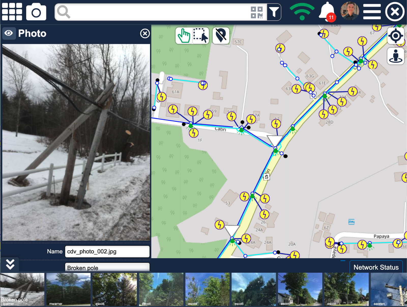
Field Truth, Written Back
A crew finds a transformer the GIS has had wrong for years. Before Logos: a note in a paper stack, weeks from anyone's attention. With Logos: photographed and flagged in the field, reviewed in the office with the evidence beside the system record, and written back through a governed approval. The next crew sees the truth.
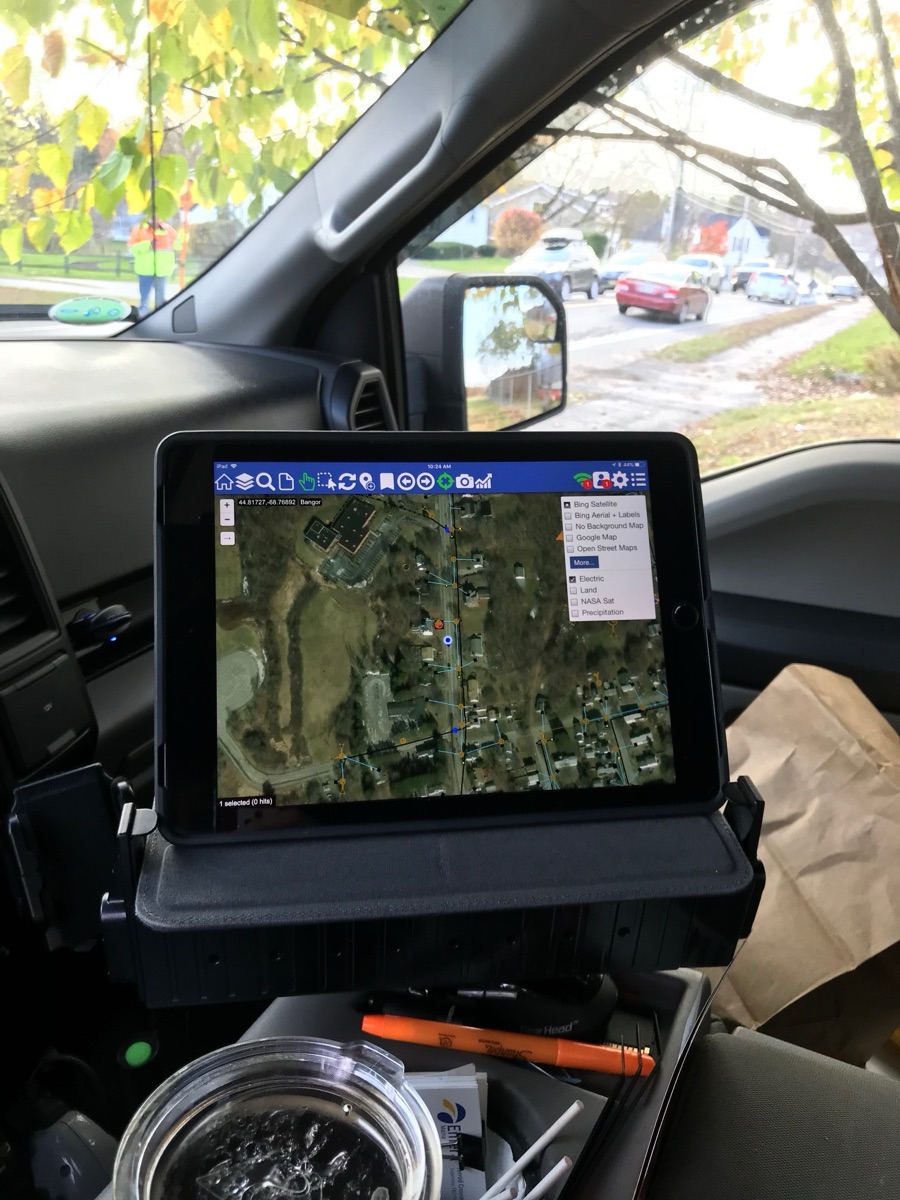
Field Crew Intelligence
A technician responds to a reported fault on a distribution feeder. Before Logos, they'd call dispatch and wait. With Logos, their Atlas app shows live asset status, connectivity topology, recent work history, and any active outage events, all before they leave the vehicle.
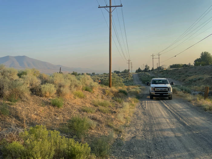
Inspections at Scale
An operations manager needs every pole overdue for inspection across three districts. With a legacy stack, that's a multi-day data pull. With Logos, it's one search, answered in milliseconds. The same index supports AI-assisted reading of inspection photos, pole by pole.
No one should make a safety decision based on an out-of-date map. The accurate data exists, somewhere. It just can't get to the people who need it most. That gap is fixable, and that's why we built this.
See Logos running on your network data.
We run a production-intent pilot on your live data: one bounded lane, your systems, a baseline captured on day one. Gains you can measure in weeks or months. Not years.